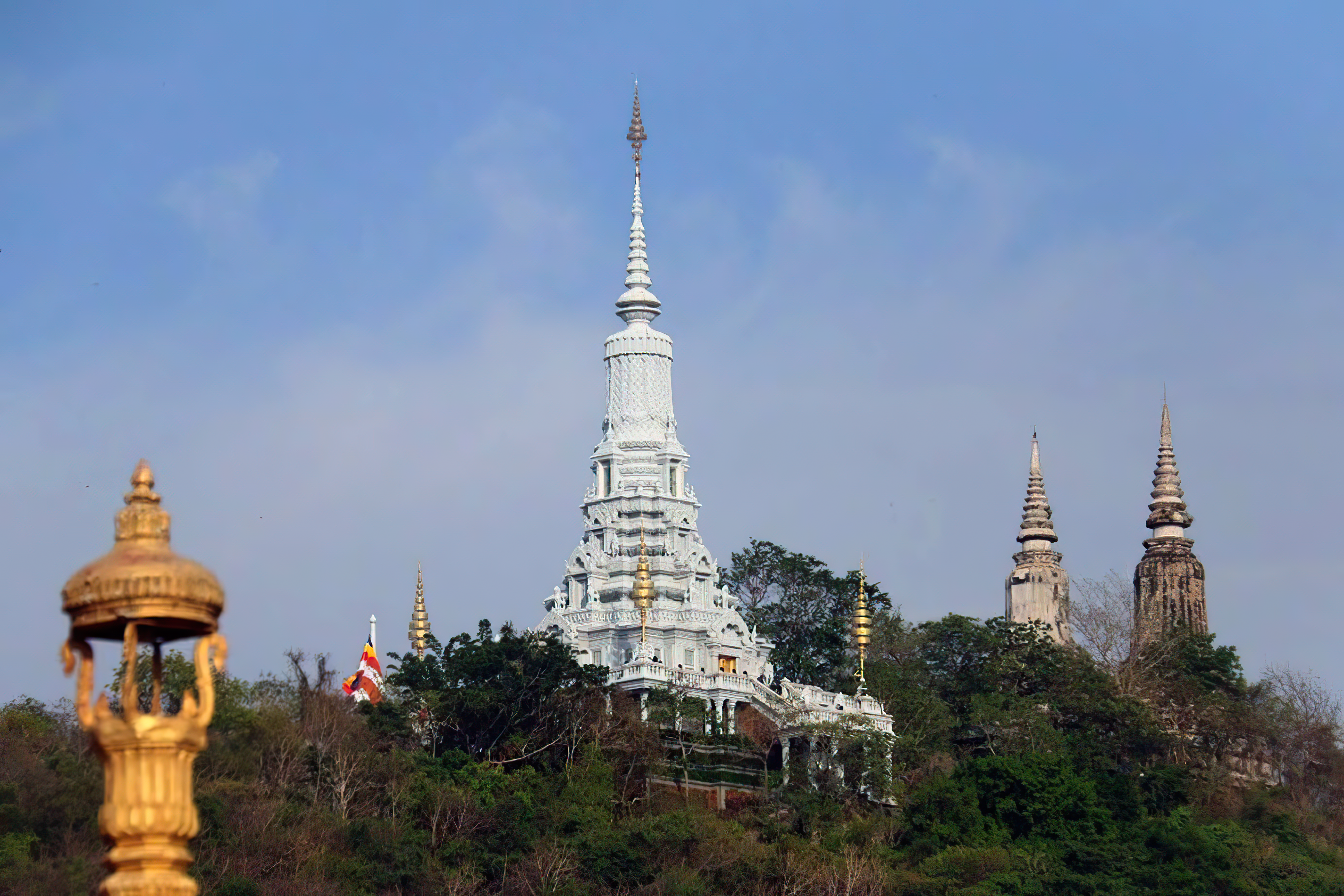
- Phnom Kulen sits 48 km north of Siem Reap at 500 meters altitude, the founding place of the Khmer Empire in 802 CE.
- King Jayavarman II declared independence and established the Devaraja cult here, unifying scattered territories into a kingdom lasting six centuries.
- LiDAR technology unveiled Mahendraparvata, the hidden capital beneath the Kulen plateau, revealing dozens of temples, roads, and canals invisible for a millennium.
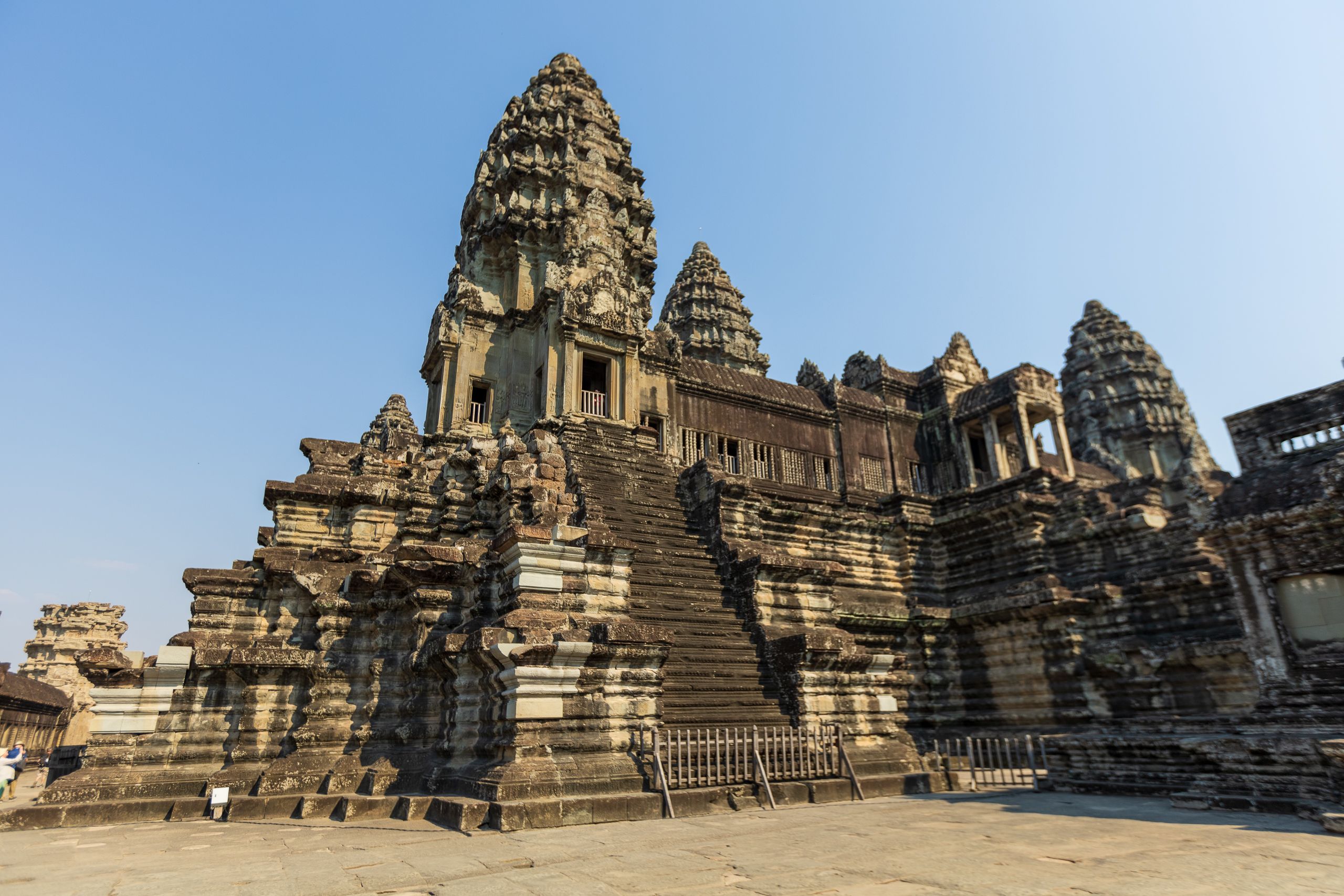
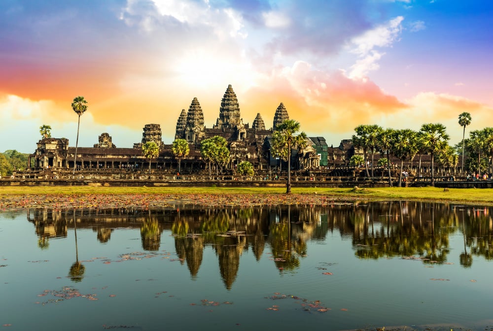
- Khmer builders quarried Kulen sandstone to construct Angkor's great monuments, linking this mountain directly to temples 30 km away.
- The Kulen waterfall and sacred riverbed inscribed with the river of a thousand lingas remain major pilgrimage and spiritual destinations today.
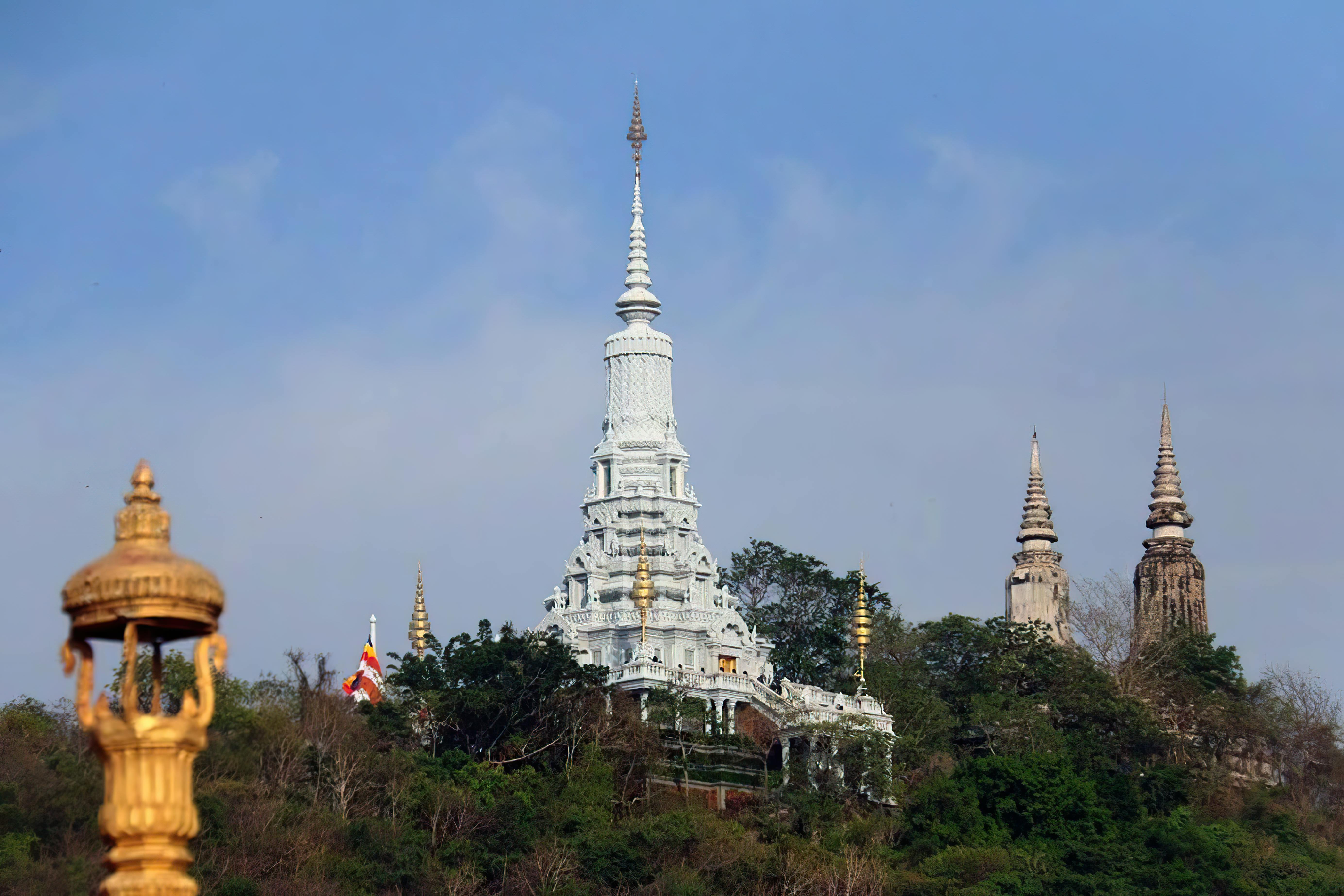
Phnom Kulen, meaning 'the mountain of lychees,' rises 500 meters above the Cambodian landscape 48 km north of Siem Reap, holding secrets that redefined our understanding of the Khmer Empire. In 802 CE, King Jayavarman II proclaimed independence here and launched the Devaraja cult, founding a kingdom that would last six centuries. Yet the mountain's true scale remained hidden until modern archaeology arrived: LiDAR surveys conducted from 2012 onwards revealed the lost city of Mahendraparvata, a vast urban network of temples, roads, and canals buried beneath dense jungle for over a thousand years, proving Phnom Kulen was far more than a sacred site : it was the empire's first true capital.
What is Phnom Kulen and where is it located?
Phnom Kulen is a sacred mountain range in Siem Reap province, northern Cambodia. It sits about 48 km north of Siem Reap and 30 km northeast of Angkor Wat.
The plateau rises to roughly 500 meters and stretches close to 40 km across the landscape.
The name carries a sweet history: Phnom Kulen means "the mountain of lychees." Wild lychee trees once covered these slopes, and the fruit still grows here today.
Where exactly is Kulen Mountain on the map?
Kulen Mountain lies north of the Angkor temple complex, deep within Phnom Kulen National Park. The drive from central Siem Reap takes around 90 minutes by car, longer by tuk-tuk on the climbing road.
Here are the key markers to picture its position:
- Distance from Siem Reap: about 48 km north
- Distance from Angkor Wat: about 30 km northeast
- Altitude: roughly 500 meters above sea level
- Plateau length: close to 40 km
What is the geological context of the sandstone plateau?
The plateau is built from thick layers of sandstone. This stone shaped not only the mountain itself but much of the Angkor civilization below.
Khmer builders quarried Kulen sandstone to raise their temples. Blocks cut here traveled south to construct the great monuments of the Angkor period.
The Samré people, an ethnic group long settled around the mountain, lived alongside this quarrying activity. They worked the land and the stone across generations.
Traces of the old quarries still mark the rock surfaces today. Walking near them, you sense the human labor that linked this mountain to the temples you came to Cambodia to see.
Why is Phnom Kulen so important in Khmer history?
Few places carry the weight of Cambodian history like this plateau. The mountain holds the origin of an empire and the memory of its darkest years.
How did the Khmer Empire begin here?
Phnom Kulen is the birthplace of the ancient Khmer Empire. A ruler stood on this plateau and set in motion the civilization that would build Angkor.
The site marks the founding moment of a kingdom that lasted six centuries. Everything visible at Angkor traces back to a decision made on this mountain.
In 802 CE, King Jayavarman II proclaimed independence from Java here. He launched the Devaraja cult, declaring himself a universal monarch linked to the divine, and unified the scattered Khmer territories under one crown.
What was the lost city of Mahendraparvata?
The plateau once held a royal capital, not just a sacred shrine. Under later kings, the mountain became a center of power and worship.
Mahendraparvata means "the mountain of the Great Indra." The capital flourished here under Udayadityavarman II, who built temples and a vast urban network across the high ground, as documented in the UNESCO tentative listing.
The city predates the famous monuments on the plains below. It set the template for the urban planning that later defined Angkor itself.
Mahendraparvata stayed hidden under jungle for centuries. Modern laser surveys revealed a full city plan beneath the trees, confirming the mountain as the empire's first true capital.
What role did the mountain play in recent history?
The mountain served as a refuge in recent times. In 1979, the Khmer Rouge used the remote plateau as one of their final strongholds before retreating.
The dense forest that once hid an ancient capital later sheltered a regime in collapse.
This layered past gives Phnom Kulen its quiet gravity today. Pilgrims, historians, and travelers all climb the same slopes, drawn by a place that holds both creation and loss.
What archaeological treasures hide on the Kulen plateau?
The Kulen plateau holds one of Southeast Asia's richest archaeological landscapes, much of it still unexplored. Centuries of worship, royal building, and daily life left layers of structures across the high ground.
Researchers continue to map the site, as detailed in the Smithsonian Magazine account of the lost city.
The plateau hides a remarkable range of remains:
- Around forty brick temples scattered across the forest
- A mountain temple-pyramid raised by royal command
- Prehistoric sites predating the Khmer Empire
- Rock paintings on sheltered stone surfaces
- Hermit caves carved into the cliffs
- Ceramic kilns that fired pottery for the region
What did LiDAR technology reveal recently?
Aerial laser surveys changed how we understand this mountain. Scanning through the canopy, the technology exposed shapes invisible from the ground.
The data revealed a planned urban network across the plateau. A grid of earthen dykes, roads, and city blocks emerged, confirming Mahendraparvata as a deliberately engineered capital.
The LiDAR scans uncovered a complete city plan buried under centuries of forest, with streets, dykes, and temple platforms laid out in a precise grid.
How did the ancient hydraulic system work?
The Khmer engineers built a sophisticated system to control water on the high ground. Reservoirs collected the monsoon rains, while dykes and canals directed the flow across the plateau.
Ponds and raised platforms completed the design, storing water and supporting the city above the flood line. This network sustained a population at altitude, far from any large river.
The water carried meaning as well as use. It flowed over carved lingas, gathering sacred power before descending to the plains.
That blessed water reached Angkor below, feeding the canals and rice fields that fed the empire. The mountain's hydraulics linked spiritual ritual directly to the irrigation that kept the kingdom alive.
Which Phnom Kulen attractions should you visit?
A day on the plateau moves between water, stone, and prayer. Four sites stand out, each rewarding the climb in its own way.
The descriptions below cover what to expect and how to plan each stop.
What makes Kulen Waterfall a must-see?
Kulen Waterfall falls in two stages over the sandstone cliffs. The upper tier drops gently into a wide pool, while the lower tier plunges around 20 meters into a basin below.
You can swim in both pools, and most visitors choose the larger lower basin. Local families spread picnics on the banks, and the spray cools the forest air.
The sound of falling water carries through the trees long before you reach the edge.
Practical tip: arrive before 9 AM to swim in near silence, before the tour groups fill the lower pool.
Why visit Preah Ang Thom and the Reclining Buddha?
Preah Ang Thom is a monastery founded in the 16th century. A short flight of steps leads up to its main shrine on the highest point of the plateau.
The centerpiece is a 16-meter Reclining Buddha carved directly into a single sandstone boulder. Monks hewed the figure from the living rock, and it now rests under a wooden pavilion.
This is the most sacred spot on Phnom Kulen. Cambodian pilgrims climb here year-round to leave incense, lotus flowers, and small offerings.
Remove your shoes before entering and cover your shoulders and knees. The shrine remains an active place of worship, not a museum.
What is the River of a Thousand Lingas?
The River of a Thousand Lingas runs over a carved riverbed at Kbal Spean. Khmer artisans cut hundreds of lingas, the symbol of Shiva, into the stone beneath the flowing water.
Carvings of Vishnu, Brahma, and other Hindu deities line the banks alongside the lingas. The water passing over them was believed to gather blessing before reaching the rice fields below.
You walk a forest trail to reach the carvings, following the stream upstream.
Tip: visit during the dry season, from November to April, when low water levels expose the carvings most clearly.
Where to find Srah Damrei and the stone elephant?
Srah Damrei holds a 6-meter stone elephant standing in a forest clearing. Carved life-size from a single boulder, it is joined by smaller lions and other animal sculptures.
The figures sit far from the main visitor circuit, deep in the woods.
Reaching Srah Damrei requires a guided hike or motorbike ride along rough forest tracks. Expect a moderate trek of one to two hours, suited to travelers in reasonable walking condition.
What unique experiences can you have on Kulen Mountain?
The plateau rewards travelers who step past the four headline sites. A handful of slower experiences turn a day trip into a memory you carry home.
Is a sunrise hike to the summit worth it?
The sunrise hike trades a lie-in for the plateau waking up around you. You climb in the dark, reach a high lookout, and watch light spread over the forest canopy below.
The cool morning air and near-empty trails make the early start worthwhile.
Pack these before you set out:
- An early departure, on the trail by 4:30 AM
- Sturdy closed shoes with grip for uneven rock
- At least one liter of water per person
- A headlamp to keep your hands free in the dark
How to experience a homestay near the national park?
A homestay near Phnom Kulen National Park places you inside village life. You share meals with a Khmer family, learn a few words of the language, and sleep to the sound of the forest.
Hosts often show you how they cook, farm, or harvest wild lychees on the slopes.
This kind of stay keeps your money in the community rather than a distant chain. You gain a slower, honest view of rural Cambodia, and your hosts gain steady, dignified income.
What about 4x4 and motorbike jungle adventures?
A 4x4 ride climbs muddy tracks to corners of the plateau most visitors never reach. On a guided motorbike, you weave to hidden caves and quiet carvings deep in the trees.
These outings suit travelers who want the jungle on its own terms.
Keep these points in mind before you book:
- Ride only with a licensed local guide who knows the tracks
- Wear a helmet, long sleeves, and closed shoes
- Suited to confident, reasonably fit adventure travelers, not young children
To wake up close to these trails and roll out at first light, base yourself at a boutique stay minutes from the Kulen road at Villa Agati.
How to plan your visit to Phnom Kulen National Park?
A visit to Phnom Kulen National Park works best as a full-day trip from Siem Reap. You reach the plateau by car or tuk-tuk, climbing a single road that opens for ascent in the morning and descent in the afternoon.
Plan for an early start and a late return to fit the waterfall, the shrine, and the river of a thousand lingas into one day.
When is the best time to visit?
Arrive in the early morning for the waterfall and choose the dry season for the lingas. The pools sit calm and quiet before the crowds, and low water exposes the carved riverbed clearly.
The table below compares the two main seasons and the sites each one favors.
| Period | Conditions | Best sites |
|---|---|---|
| November to April (dry) | Cool, low water, clear trails | River of a Thousand Lingas, Srah Damrei |
| May to October (wet) | Lush forest, full waterfall, muddy tracks | Kulen Waterfall at its strongest |
What should you know before going?
A few practical notes save time and respect the sacred ground.
- Dress modestly: cover shoulders and knees for the Reclining Buddha shrine
- Buy the Kulen entrance ticket, separate from the Angkor pass
- Follow the one-way road: up before 11 AM, down after noon
- Set aside a full day to move between the four main sites without rushing
Plan your route around the road schedule: reach the summit shrine and waterfall first in the morning, then drift toward Kbal Spean and Srah Damrei before the afternoon descent opens in 2026.
To start each morning minutes from the Kulen road, settle into a boutique base near Siem Reap at Villa Agati.
What is the protected status of this sacred mountain?
Phnom Kulen carries formal protection on two fronts: as a national park and as a heritage site under review. Cambodia has worked to secure both its forest and its monuments for future generations.
International recognition keeps growing as researchers reveal more of the plateau's significance.
The site holds these layers of protected status:
- Phnom Kulen National Park, managed for recreation, conservation, and ongoing scientific study
- Inscription on Cambodia's UNESCO World Heritage tentative list on March 27, 2020
- Listed under criteria for outstanding cultural value, archaeological depth, and links to the Khmer civilization
Beyond law and listing, the mountain remains a living holy place. Cambodians regard Phnom Kulen as one of the most sacred sites in the country's Buddhist tradition.
Many believe the Buddha himself walked these slopes, leaving the ground blessed.
That faith draws pilgrims up the same road travelers climb today. The protection here guards not only stone and forest, but a devotion still very much alive in 2026.
Frequently Asked Questions about phnom kulen
What is Phnom Kulen and why should I visit it?
Phnom Kulen is a sacred mountain plateau located 48 km north of Siem Reap in Cambodia, rising 500 meters above the landscape. It holds immense historical significance as the founding place of the Khmer Empire in 802 CE, where King Jayavarman II proclaimed independence and established the Devaraja cult. The name Phnom Kulen means 'the mountain of lychees.' Beyond its spiritual importance, modern LiDAR technology has revealed the lost capital of Mahendraparvata hidden beneath the plateau, making it essential for understanding Khmer history and culture.
Where is Kulen Mountain located relative to Siem Reap and Angkor?
Kulen Mountain is situated approximately 48 km north of Siem Reap and about 30 km northeast of Angkor Wat, within Phnom Kulen National Park. The plateau stretches nearly 40 km across the landscape at an altitude of roughly 500 meters. The drive from central Siem Reap takes around 90 minutes by car, traveling along a climbing road that ascends the mountain.
What is the River of a Thousand Lingas at Phnom Kulen?
The River of a Thousand Lingas is a sacred riverbed at Phnom Kulen inscribed with thousands of intricate linga carvings, ancient symbols of Hindu-Buddhist spiritual devotion. This remarkable site remains a major pilgrimage destination today, attracting visitors seeking spiritual connection and cultural understanding. The river represents the sacred nature of the mountain and its enduring importance as a spiritual center.
What can you see at the Kulen waterfall?
The Kulen waterfall is one of the most significant natural features of Phnom Kulen National Park and a major attraction for visitors. This scenic waterfall serves as both a natural landmark and a spiritual pilgrimage site, drawing travelers who seek to experience the mountain's sacred character. The waterfall represents the intersection of natural beauty and spiritual significance that defines Phnom Kulen.
How is Phnom Kulen connected to the temples of Angkor?
Phnom Kulen is directly connected to Angkor's great monuments through the sandstone quarried from Kulen Mountain. Khmer builders extracted blocks from this plateau and transported them approximately 30 km south to construct the famous temples visible today. The quarries at Phnom Kulen provided the essential building material for Angkor's architectural achievements, making the mountain foundational to the empire's most celebrated creations.
What is Mahendraparvata and why is it important?
Mahendraparvata is the lost capital city of the early Khmer Empire hidden beneath Phnom Kulen National Park's jungle for over a thousand years. LiDAR surveys conducted from 2012 onwards revealed this vast urban network containing dozens of temples, roads, and canals beneath the dense vegetation. The discovery of Mahendraparvata fundamentally changed our understanding of the Khmer Empire, proving that Phnom Kulen was not merely a sacred site but the empire's first true capital.